
Paddling Through Human and Earth History Along The Rock River Trail
Spring is just around the corner and open water on area rivers is not far behind. In a time of COVID-19 there may be no safer place for social distancing than paddling a canoe out on the water.
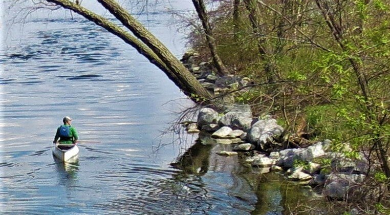
Paddling is one of the fastest growing outdoor activities in the U.S. With over 15,000 lakes and 12,000 rivers Wisconsin is a top destination in the Midwest for paddlers. In Southern Wisconsin paddling enthusiasts need not venture far to experience some of the best canoeing and kayaking in state. The Rock River with over 320 miles end to end is one of the better trails in the entire region. From the headwaters at the Horicon Marsh to crossing the Illinois border and ending in the Quad Cities where it empties into the Mississippi River, there are many segments along the route to enjoy.
The Rock River is also a National Water Trail, the first designation for the states of Wisconsin/Illinois by the US Department of the Interior. According to the National Park Service, the National Water Trail System “is an interagency collaborative effort administered by the National Park Service though the Rivers, Trails, and Conservation Assistance Program and the National Trails System.”
The National Water Trail designation indicates that federal, state, and local organizations came together to ensure recognition, ecosystem restoration covering issues such as water quality, environmental protections, and universal signage along the entry points of the Rock River. The water trail designation also acknowledges that along the route are a variety of landscape formed by glacial activity in the region. The flora and fauna and the historical significance of the river basin are of national importance as well.
One of the more notable historical figures in the region is the great, Sauk leader, Chief Black Hawk. The Rock River has played a substantial role in the development of human communities along its’ banks for centuries dating to the early Woodland Indians and descendants of the Ho-Chunk people.
The Rock river also serves as a habitat and stopping point for migratory birds. It’s not unusual to see groups of American White Pelicans, Green Herons, Great Blue Herons along the route as you paddle downstream. The Rock River is also home to muskrats, minks, voles, and river otters as well as amphibians, and reptiles.
For the paddling enthusiast, there are 150 entry points along the Rock River trail. 50 of those launch areas are accessible for people of disabilities. Janesville and Beloit have launch sites available. Unfortunately, paddlers cannot travel the entire 320 miles of trail continuously. Beloit for example has one dam while Janesville has two.
One of the keys to a safe, fun, and successful paddling adventure is remaining vigilant of Wisconsin’s ever-changing weather conditions in the spring and summer months. Additionally, it is recommended that you get up to date streamflow data for the Rock River at the US Geological Survey’s website. Please visit https://waterdata.usgs.gov/wi/nwis/current/?type=flow for condition information specific to
the state of Wisconsin.
Before you go
The American Canoe Association (ACA) recommends the following essentials for
each paddling excursion:
- · Carry an extra paddle
- · Sun Screen
- · Bilge pump or bailer (a bucket to remove water from your craft)
- · Eye Protection Duct Tape or small repair kit (patch a hole or temporarily mend other equipment)
- · Chart or Map of Rock River (Rockrivertrail.com is a great resource for maps)
- · Water
- · Weather Radio or weather App and GPS device
- · First Aid Kit with Matches
- Proper footwear
- · PFD (Personal Floatation Device)
Please consult the Rock River Trail resources at Rockrivertrail.com to plan your next trip.
The website provides in depth information about the best places to launch your canoe or kayak
as well as updates to the trail. Happy paddling.