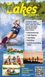

HOME | FISH | BOATING | THINGS TO DO
Hike To The Top of Rock County's 2nd
Highest Point Magnolia Bluff
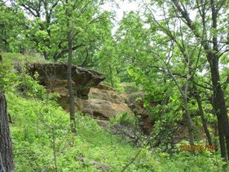
(Photo courtesy of Rock County, Wisconsin)
Last Updated: 04/10/25 Reading Time: 10 Minutes
Located just minutes south of Evansville Magnolia County Park is truly one Southern Wisconsin's great local hiking treasures. What makes the park such a great trail lover's destination? Magnolia Bluff is about varied terrain on a smaller scale to the area's most famous and popular park, Devil's Lake State Park. The 120 acre park is only about 25 minutes from Madison and yet feels as remote as some of our region's Ice Age trails featuring dramatic rock ledges and dramatic views over the surrounding Rock County farmlands.
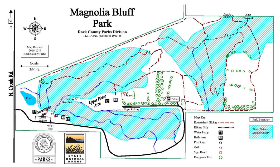
Magnolia Bluff County Park has two parking lots. The lower level lot is located at the park's only entrance (off Croak Road) where the main trailhead is located. From this trail hikers can find their way to the top of the bluff. Hikes along this trail are a bit of a challenge as the widths are from nearly three feet at the widest to around 20 inches with vibrant undergrowth hanging along the edges. On the foot hikers will find a sandy/soil mix which is subject to extreme weather conditions, note the erosion control pads at the beginning of the trail. The trail is a bit of a challenge varying from flat segments to more rocky narrow mini paths under foot.
291 feet Magnolia Bluff
off Croak RoadMagnolia Bluff County Park is located approximately 18 miles from central Janesville. The park is just south of Evansville, and located 1/2 miles south of the intersection of State Hwy 59 and Croak Road, on Croak Road.
A portion of this park is designated as a Wisconsin State Natural Area (SNA). SNAs protect outstanding examples of Wisconsin's native landscape, significant geological formations and archaeological sites. This designation was made cooperatively with Rock County and the Wisconsin Department of Natural Resources. The land management is also a cooperative venture. To learn more, please read the State Natural Area brochure.
This 120 acre park features beautiful rock outcroppings and vistas. Because this park has steep areas and rock outcroppings, caution must be used by all park visitors. Picnic tables, grills, drinking water, and restroom facilities are provided. In an effort to keep the areas as pleasing as possible, dumpsters are provided.
Two trails are featured: one a bridle and nature trail; the other a cross-country ski and hiking trail. The bridle trail was made possible through the efforts of the Tri-County Riders Club and is also open for walking. The cross-country ski and hiking trail was constructed by the YACC (Young Adult Conservation Corps) in 1981 with funding for materials and supplies provided by Rock County. Skiing trails are not groomed. The trails of Magnolia Bluff Park are open every day from dawn to dusk. Skiing at night is not permitted for safety reasons.
Located in the hilly western upland region of Rock County, Magnolia Bluff marks the second highest point and the only relatively undisturbed cliff in the county. Comprised of Galena dolomite and St. Peter sandstone, the bluff, including its narrow ridgetop, has been deeply incised by natural drainage ways with open and shaded cliffs flanking the sides. Southern dry-mesic forest dominated by black oak covers most of the area with white oak, bur oak, shagbark hickory and American elm. Paper birch, found at only a handful of locations in the county, is locally abundant on the north-facing slopes.
The cliffs and dry, open slopes above support several plant species including ebony spleenwort, smooth cliffbrake, rusty woodsia, spike-moss, common rockrose, bird's-foot violet, huckleberry and small skullcap. A state-threatened species is also present here. On the crest and upper slope of the bluff is a small dry prairie remnant with little bluestem, side oats grama grass, rock sandwort and blue-eyed grass. Magnolia Bluff is owned by Rock County and was designated a State Natural Area in 2011.
--------------------------------
From south Madison, take Exit 261 off US12 onto US14 and proceed south for 19 miles to Evansville. At this town's north edge, turn off US14 to the right (south) onto WI 213. Go south 3.3 miles and turn right (west) on WI 59. After traveling 3.0 miles through farmland on WI 59, turn left (south) on North Croak Road. After 0.5 miles, turn left (east) into Magnolia Bluff County Park. There is parking and rest rooms near this entrance, but you can drive up to the parking lot on the top of the bluff. As the road reaches the bluff top, it turns sharply to the left (south) and there you can see a trailhead on the right (north). If you look at the topo, the county park line follows the north edge of Section 17 (which is the south edge of Section 8), with the highest land being in corn and the actual bluff being wooded county land. Although tricky to the naked eye, hand-leveling easily proves that the highest point is on the park boundary (a poor fence line at the wood's edge) and not in the farm field. Hand leveling also confirms that the second area off to the east is lower, but since this is such a down right pleasant place, it is worth it to your soul to stroll the half mile to the east and visit it.
On this cohp, I performed a nifty trick which I did not describe in my write-up for the web site. On the rise that is the highest point (on the section line of sw sw section 8), I walked to the east downhill just enough so that my eyes were equa-elevation with the highpoint top. I could determine this by hand- leveling to the hilltop, although it took some walking up and down hill until my eyes were exactly the height of the hilltop. I then turned to the east and sighted over to distant hilltop which was the second HP area. It was much lower than my level. I could have easily laid down prone on the highpoint and sighted over to the distant hill, but sometimes the snow or mud or thorns might make this uncomfortable.
Sighting to distant (2,000') hilltops is possible because the hills were snow covered and stood out dramatically against the leaf-bare trees. I doubt that the curve of the hill could be discerned at other times of the year when vegetable matter makes the horizon fuzzy.
If you look at the topo, the county park land encompasses the entrance road, the bluffs in southeast section 7, and the bluff arm in sw sw sec. 8. This 120 acre park hosts the only natural stand of white birch in the county due to a micro-climate on the north bluffs.
The park is open 5am - 10pm. Call 608-757-5450.
Events
No Events Scheduled
Lakes Nearby
| Lake Info. | Data |
|---|---|
| Area | 73 acres |
| Max. Depth | 23 feet |
| Median Depth | 18 feet |
| Boat Landings | 1 |
| County | Rock |
| Fish | Panfish, Largemouth Bass, Northern Pike and Walleye |
Towns Nearby
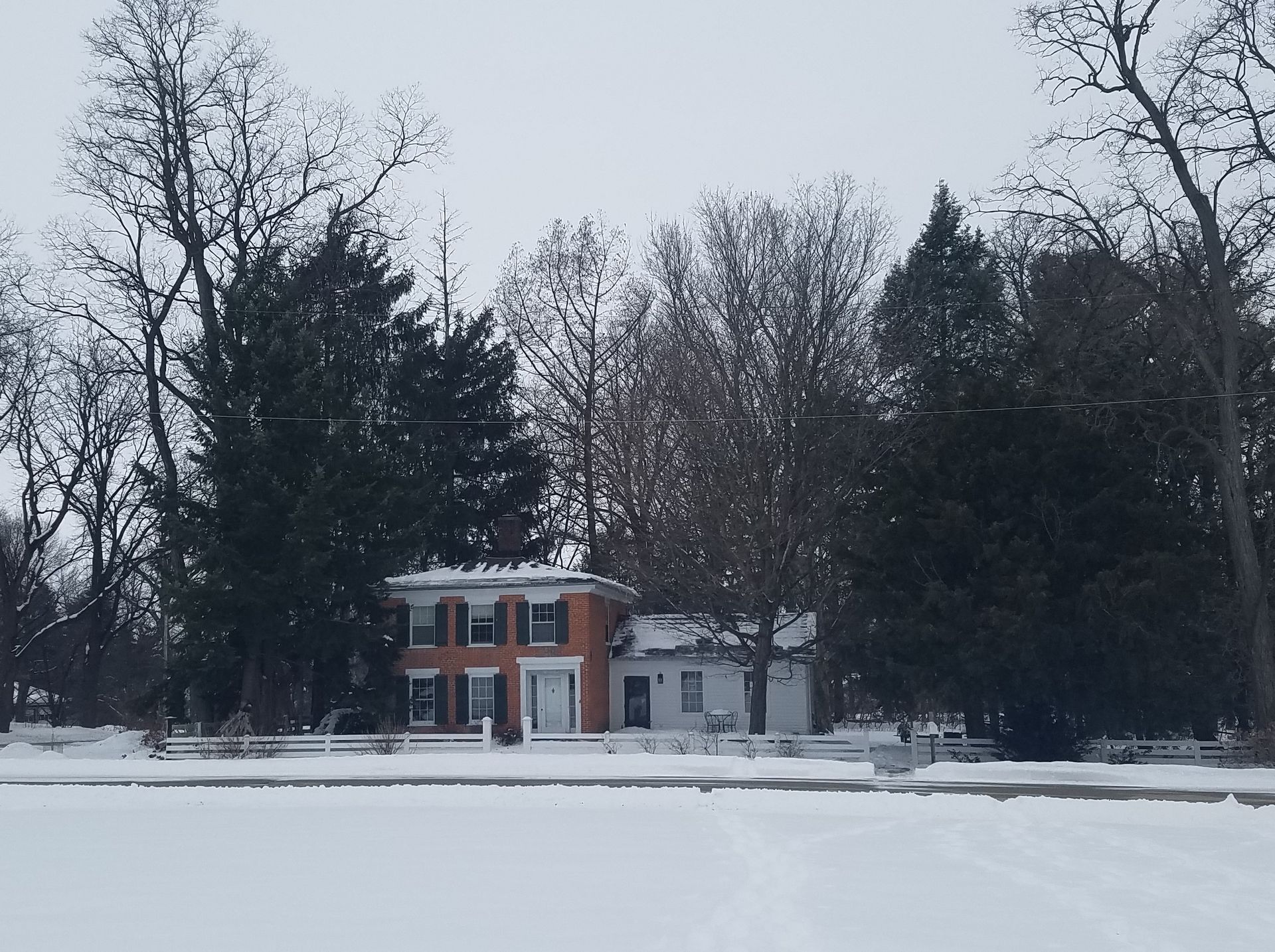
Evansville
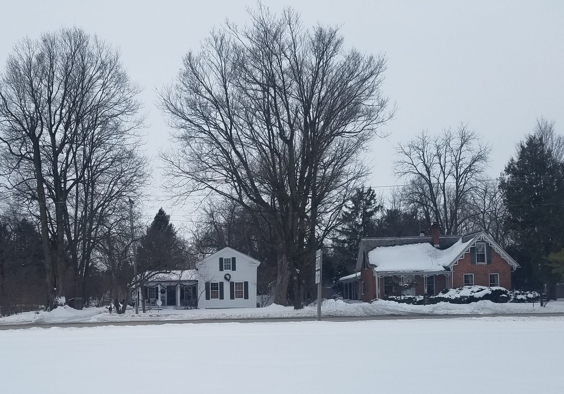
Described as a quaint New England town the settlement dates to the late 1840s. The homes in Cooksville are listed on the National Register of Historic Places (NRHP) and date from the 1840s - 1860s. A popular tourist destination is the Cookesville General Store which has been open since 1846 two years before Wisconsin became a state.
Footville
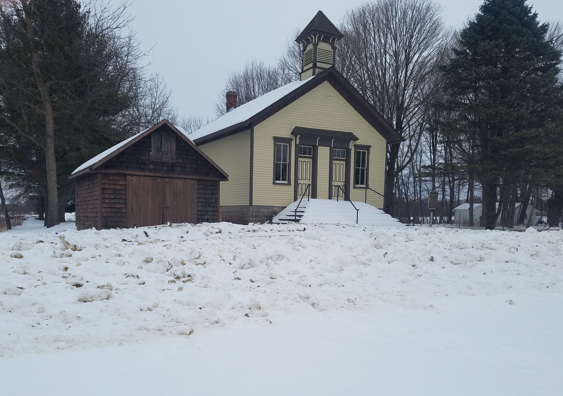
Home to possibly the world's only telephone museum housed in a telephone switchboard building. The building along with the Old Footviille State Bank and Luther Valley Church are owned and operated on appointment basis by the Luther Valley Historical Society. To set up a tour of these historic structures call (608)-752-1104.
HOME | FISH | BOATING | THINGS TO DO